Blue trail to red trail
Distance: 1.66 miles
Durration: 1 Hour
Elevation Min: 187ft
Elevation Max: 652ft
Elevation Gain:465ft
Maps: Massachusetts DCR: Mt. Sugarloaf State Reservation http://www.mass.gov/eea/docs/dcr/parks/trails/sugarloaf.pdf
Parking: 42°28'4.45"N, 72°35'42.65"W
It has been a long time since I've been able to go on a hike. August got too crazy for me with two band camps, drum corps, and getting ready for school. My first weekend off at school I finally got out to do a classic Pioneer Valley hike at Mt. Sugarloaf State Reservation!
From the parking lot there's a path that goes into the woods - follow it and cross the road (alternative to hiking up is driving up, many people do that for picnics and what not) and you'll find the blue trail makers for the Pocumtuck Ridge Trail (info), follow these all the way to the summit. The trail is incredibly easy to follow, yet incredibly difficult to climb quickly. It's incredibly steep even with switchbacks ever 30 or so feet. Partial views are available through trees on the way up, getting more and more pretty the higher up (crazy how that works!).
Some of the many swtichbacks on the way up.
A quick side trail brought us to this view! There were beginning to be signs of fall.
Some more early stages of foliage.
More partial views as we're getting closer to the summit.
"We're so close to the sky!" We turned around and got this great view. A little lower than the classic view (which we got a few minutes later). These were taken just below the summit.
After the grueling climb we were rewarded with one of the most iconic view in the pioneer valley. THe winding Connecticut River flowing south towards UMass and the Mt. Holyoke/Mt. Tom ranges. Every time I see it it takes my breath away. The summit was pretty crowded (as expected on a Saturday afternoon) but there was plenty of room for us to lay out and relax for a bit.
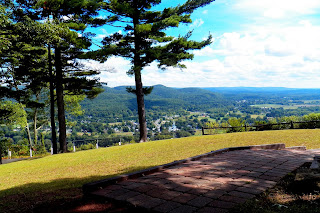
The view from where we parked in the shade to relax.
Views from the summit pavilion.
The hike down starts off following the summit road, then hopping off back on the blue trail on the right to another gorgeous view of Mt. Toby and the Connecticut River. After that the hike gets pretty steep again before reaching the bottom and turning left onto the red trail back to the parking lot!
Views from the second overlook with a glorious, shaded bench.
The trail follows the road for a very short distance. The blue trail continues to North Sugarloaf and further along the Pocumtuck Ridge trail, and then there's another post that says "Red to Parking along 116."
This was a super cool hollowed out tree on the red trail, I wonder how it got like this?
This is such a classic Pioneer Valley hike and it was a great way to get back into things. I had driven to the top once and walked along the road another time due to the snow and ice, but there's nothing like taking the time and energy to really hike up.


No comments:
Post a Comment