Mt. Tammany
Worthington State Forest
Dunnfield Creek Natural Area
Distance: 7.32 miles
Duration: 3 hours, 40 minutes
Elevation Min: 323ft
Elevation Max: 1549ft
Elevation Gain: 1226ft (1701ft throughout entire hike)
Maps: New York-New Jersey Trail Conference #120
Parking: N40 58.291 W75 07.531

When driving on 80W, there is a "Dunnfield Creek Natural Area" sign a mile before the parking lot. From there there are two parking lots, we parked in the second one, but either one works since they are connected via the red dot trail. There are two ways to get to the top of Mt. Tammany. There's the green Dunnfield Creek trail to the blue trail, or the route we took via the red dot trail. The green to blue is longer and more gradual, and going down the red dot can be dangerous. Personally I'd rather go up steeply than go down.
Right out of the parking lot we hopped onto the Tammany Trail (red dot). It's incredibly steep, climbing ~1200 feet in a little over a mile. About halfway up the trail there are obstructed views of the river and Mt. Minsi, and of the northern valley through the trees if you turn around. As we got closer to the view, there were a few side trails to rock outcroppings for more obstructed views. After the last bit of up, we could tell the view was close because there was literally no more mountain anywhere around us, or as I say, "the sky is so close!" There were a few groups of people at the overlook, which is expected for this hike. My best luck with privacy has been starting the hike around 8:30am on a weekday.

The climb starts immediately!

A view about halfway up of the river and Mt. Minsi.

A LOT of rock scrambles.

Partial views from side trails.

The sky is so close!

Not sure who this fella is, but he's gorgeous!

More obstructed views.

The trail gets much more user-friendly towards the overlook.

The gorgeous view of Mt. Minsi from the top! There's better views from down where those girls are, but I didn't want to wait around for them to move.

It was super cool seeing how the sunlight can change how the mountain looks!
From the overlook, if you continue in the direction that the trail was going the blue trail. The blue dot trail follows the ridge and it incredibly scenic. We passed a few people (AND SO MANY BEAUTIFUL DOGS), and we also saw a large milkweed bush with some gorgeous Common Leopard butterflies! The trail continues on the ridge, and then turns left at a very clear sign to descend the mountain. The NYNJTC map shows a woods road (Mt. Tammany Fire Road) continues straight, and we planned on following that to Sunfish Pond but it was fairly overgrown (like a 4/10 on my unhappy scale) and we didn't want to tempt fate with ticks, snakes, and the possibility of it getting more overgrown.

The trail head for the blue trail.


Some photos of the butterflies on the milkweed!

The blue trail turns here, and the woods road continues on but it was too overgrown for our liking.
We decided to reroute the hike and not go to Sunfish Pond this trip since it was warmer than we anticipated and didn't bring enough water. We followed the blue trail gradually down the mountain, crossing a few small streams. The trail ends at a junction with the green Dunnfield Creek trail and we turned right. We followed the green trail across the bridge and took a quick lunch break along the creek. From there we followed the (very wet) green trail until taking a sharp right onto the AT.

This was the most water we crossed on the blue trail.

I believe this bridge is new after Hurricane Irene, but don't quote me on that.

The gorgeous Dunnfield Creed from the bridge! There's a nice cool breeze and a gentle mist right on the bridge. It was incredibly refreshing.

Where we had our picnic!

This is where the AT breaks off from the green trail. This hike went back and forth between the Delaware Water Gap National Recreation Area and Worthington State Forest.
The lunch break was vital to this hike because we started climbing again when we got to the AT. We ascended roughly 450ft on the gorgeous AT, crossing a few streams again and enjoying the landscape (and not passing any other hikers, which was surprising for the AT this time of year). We followed that trail until a very clear junction with the yellow trail on the left, and the red Holly Springs trail to the right, which we took.

There were an incalculable amount of ferns on this branch of the AT.

More ferns! It was a nice hike like this for the time we spent on the trail. Slight incline, and just a little wet.

The Holly Springs trail head.
The red Holly Springs trail was another nice trail. It was a little overgrown, but only like a 2/10. The trail brought us down most of what we just climbed, and had some really nice small waterfalls on it. Later on in the trail it became completely inundated though, which was slow going since we were trying to avoid wet shoes (foreshadowing). I would highly recommend some shoe covers or simple shopping bags for this trail. This trail terminates back at the green Dunnfield Creek trail, which we turned right on.

Saw this beauty on the Holly Springs trail!

The Holly Springs? Maybe? There was no way to tell. There were a few streams like this.

From my understanding, there is only camping allowed to AT thru-hikers at designated campsites. I wonder if they'd allow non thru-hikers in the off season?

At this point we were getting closer to Dunnfield Creek, and our trail became part o the stream. It was very hard to avoid getting wet.
After getting back on the green trail following Dunnfield Creek, things got really wet really fast. It went from simple rock hopping to having to cross the creek (which I don't think is the best use of the word, there was a lot of fast moving water!). We took our shoes off and I was the lucky one that got to move first. I quickly learned that stepping on the bigger rocks is a pathway for disaster, as I quickly slipped and completely soaked myself (and my poor shoes that I so carefully took care of to keep try the entire hike). After having a great laugh and finally crossing, my friend learned from my mistakes and we made the cross. I reluctantly put on my soaked socks and shoes, and we followed on.
The trail was gorgeous when it was following this smaller creek!

This was truly the most ironic sign I've seen while hiking. It was right where the trail met the water.

My very dry friend waving from the other side after I took my spill!

In the end the area was absolutely gorgeous!
From there we followed the green Dunnfield Creek trail back to the parking lot. The trail was still incredibly wet for the entire length, and in my current state at the time I didn't even care anymore so I just went for it, which was a great mistake because I forgot mud existed, so now my soaked shoes now had a solid coating of mud on them. Again- lesson learned! There was one section where the trail had eroded away, but it was easily navigable. Once we got back to where the blue trail meets the green trail it was smooth sailing and we made it back to the car in what seemed like no time!

My poor, poor shoes.

A cute side trail that is unmarked, unmapped (as of the 2012 NYNJTC Map #120), and untaken by us.

This is the part of the trail that was washed out, but the side was very stable and we crossed it no problem.

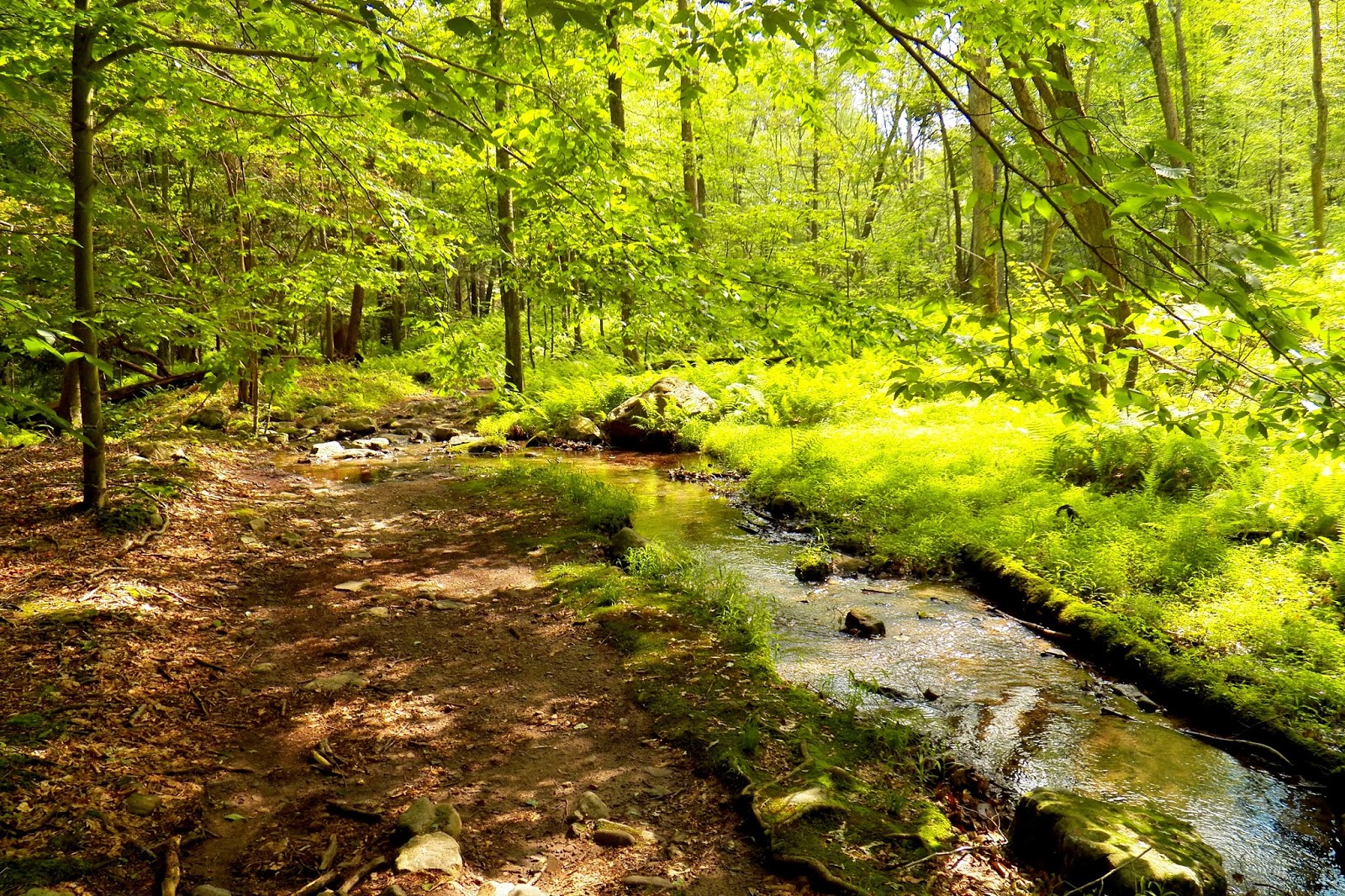
Looking back at Dunnfield Creek!

The sign at the end of the hike/at the beginning of this trail. Many people weren't following the no-swimming rule (and I'm guilty of that when I was here probably ten years ago, but hey, I was nine).
Hike Summary:
- Red dot trail from parking lot to Mt. Tammany (entire trail)
- Blue trail from Mt. Tammany to Dunnfield Creek (entire trail)
- Left onto green trail, follow until right onto the AT
- Follow AT until right on red Holly Springs trail
- Red trail (entire trail) to right onto green trail
- Follow green trail back to parking lot
No comments:
Post a Comment